
Administrator
26 March 2021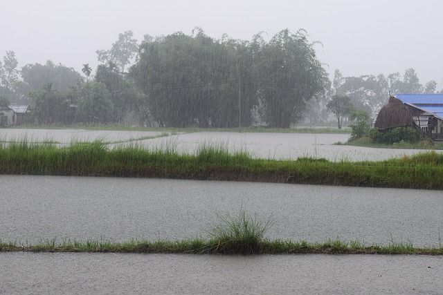
Flood like situation may also occur over the region
Heatwave conditions at isolated pockets are very likely over Saurashtra, Kutch, Konkan & Goa during 25th - 27th March and over the north Gujarat region on 27th & 28th March, 2021
According to the National Weather Forecasting Centre of the India Meteorological Department (IMD):
Salient Features
• An active Western Disturbance & its induced cyclonic circulation caused fairly widespread to widespread rainfall/snowfall/thunderstorm activity over Western Himalayan Region & Punjab during 22nd to 24th March, 2021. Isolated to scattered rainfall/thunderstorm activity also occurred over remaining parts of Northwest & adjoining central India during the same period; isolated hailstorm /dust storm activity also reported from Rajasthan on one or two days of this period.
• Due to cyclonic circulation/trough over central parts of country, light to moderate isolated/scattered rain/thundershower occurred over central India during past week (18th to 24th March, 2021).
• Under the influence of strong lower level southwesterly winds from the Bay of Bengal, fairly widespread to widespread rainfall with heavy falls at isolated places are likely over Northeast India during 29th March to 03rd April, 2021. Flood like situation may also occur over the region during this period.
• Heat wave conditions at isolated pockets are very likely over Saurashtra & Kutch and Konkan & Goa during 25th - 27th March and over north Gujarat region on 27th & 28th March, 2021.
Forecast for next two week
Weather systems & associated Precipitation during Week 1 (25th to 31st March, 2021) and Week 2 (01st to 07th April, 2021)
Rainfall for week 1: (25th to 31st March, 2021)
• A fresh Western Disturbance very likely to cause scattered to fairly widespread rainfall/snowfall over Western Himalayan Region with thunderstorm/ lightning over Himachal Pradesh & Uttarakhand and thunderstorm, lightning & hail over Jammu, Kashmir, Ladakh, Gilgit, Baltistan & Muzaffarabad during 28th- 29th March, 2021.
• Under the influence of strong lower level southwesterly winds from the Bay of Bengal, fairly widespread to widespread rainfall with thunderstorm/thunder squall/lightning and heavy falls at isolated places are likely over Northeast India during 29th March to 03rd April, 2021. It may cause landslides and low level inundation at some places during same period.
• Isolated to scattered rainfall/thundershowers are very likely over Tamilnadu, Puducherry & Karaikal, Telangana, Kerala & Mahe and coastal & south Interior Karnataka during most days of the week 1 (Annexure IV).
• Cumulatively, above normal to above rainfall very likely over parts of northeastern states and Kerala and below normal over remaining parts of the country (Annexure V).
Rainfall for week 2: (01st to 07th April, 2021)
• Due to strong lower level southwesterly winds from the Bay of Bengal to northeastern states, fairly widespread to widespread rainfall with heavy falls at isolated places are likely over this region during 1st half of the week 2. As a result above normal rainfall activity likely over this region.
• Due to absence of any active Western Disturbance, rainfall activity is likely to below normal over northwest India. It is likely to be below normal to normal over remaining parts of the country (Annexure V).
Temperature for week 1 & 2: (25th March to 07thApril, 2021)
• Maximum temperatures are very likely to rise gradually by 4-6°C over Northwest India during first half of the week 1. Gradual rise in maximum temperatures by 3-5°C over most parts of Central India and by 2-4°C over most parts of East, West and peninsular India during first half of the week 1.
• No heat wave conditions very likely over the country during next 4-5 days except Saurashtra & Kutch and Konkan & Goa where heat wave conditions are very likely at isolated pockets during 25th - 27th March and over north Gujarat region during 27th - 28th March, 2021.
• During week 2, due to likely dry weather over most parts of the country (outside northeast India), the maximum temperatures are very likely to rise gradually over most parts of the country. Hence, normal to above normal maximum temperatures likely over northwest, east India and east coast. These are likely to be below normal by 1-2°C over north eninsular & adjoining central India (Annexure VI).
Cyclogenesis:
• There is a low probability of cyclogenesis over southeast BoB during the latter half