Administrator
19 February 2023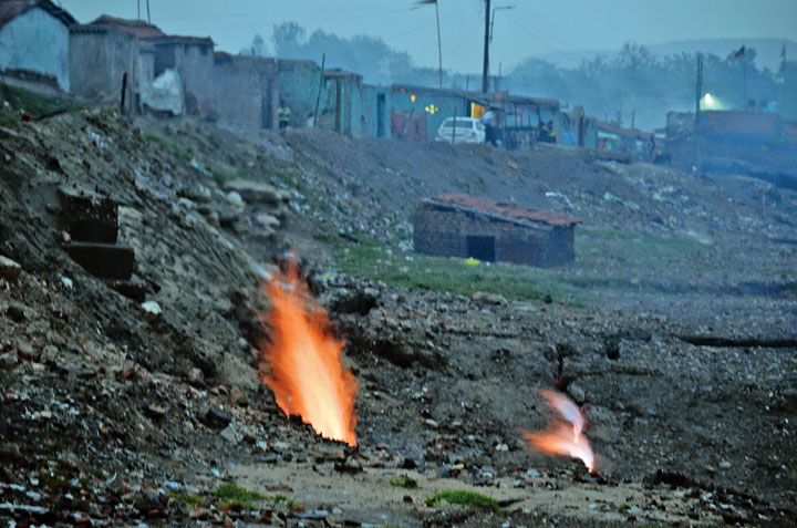
*Image credit The Telegraph
Bharat Coking Coal Ltd, Dhanbad, has and inked MoU with National Remote Sensing Centre, Hyderabad to study the underground fire in Jharia.
As per BCCL’s estimate, nearly 254 square km area carrying coking coal of Jharia is affected by the problem of underground.
BCCL, according to the MoU, has authorised National Remote Sensing Centre to study the form, depth and size of the underground fire. A team of this Centre is expected to start field work soon.
National Remote Sensing Centre( NRSC) has the mandate for the establishment of ground stations for receiving satellite data, generation of data products, dissemination to the users, development of techniques for remote sensing applications including disaster management support, geopolitical services for good governance and capacity building, according to nrsc.gov.in
The underground mines in Jharia has been a cause of serious concern for the BCCL and Union Ministry of Mines for decades. One report has claimed that there has been decrease in area of underground mine fire from 8.9 sq.km to 1.80 sq. km.
If you value our journalism, consider making a voluntary contribution to help us continue bringing news, stories and information to our readers.
Scan the QR code to contribute

Every contribution, big or small, is appreciated.